
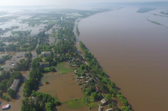

The level of the Amur River near Blagoveshchensk broke the flood records of 2013 and 1984, amounting to 860 cm, writes Kommersant with reference to the press service of the regional government.
During the day, the water rose by 6 cm. According to the regional government, 638 residential buildings were flooded in the region, 1,750 people were evacuated, of which 348 are in temporary accommodation.
In total, there are seven temporary accommodation points in the Amur Region, which are provided with everything necessary. Currently, large-scale works are being carried out in the village of Vladimirovka on the construction of temporary dams, which involve, among others, DVOKU cadets and volunteers.
It is noted that the crest of the flood is located near Blagoveshchensk. It is assumed that this water level will last up to four days. In the upper reaches of the Amur river, the water level began to fall. The flood is shifting to the Konstantinovsky and Mikhailovsky districts and moving towards the Jewish Autonomous Region.
Recall that in case of flooding, the level of the dangerous phenomenon is 800 cm. In 2013, the water in the Amur River rose to 822 cm, and in 1984 – to 857 cm .
The day before it was reported that part of the stairs leading to the upper tier of the Amur embankment was under water.
Earlier, an EMERCOM task force went to the Far East to coordinate the flood control.